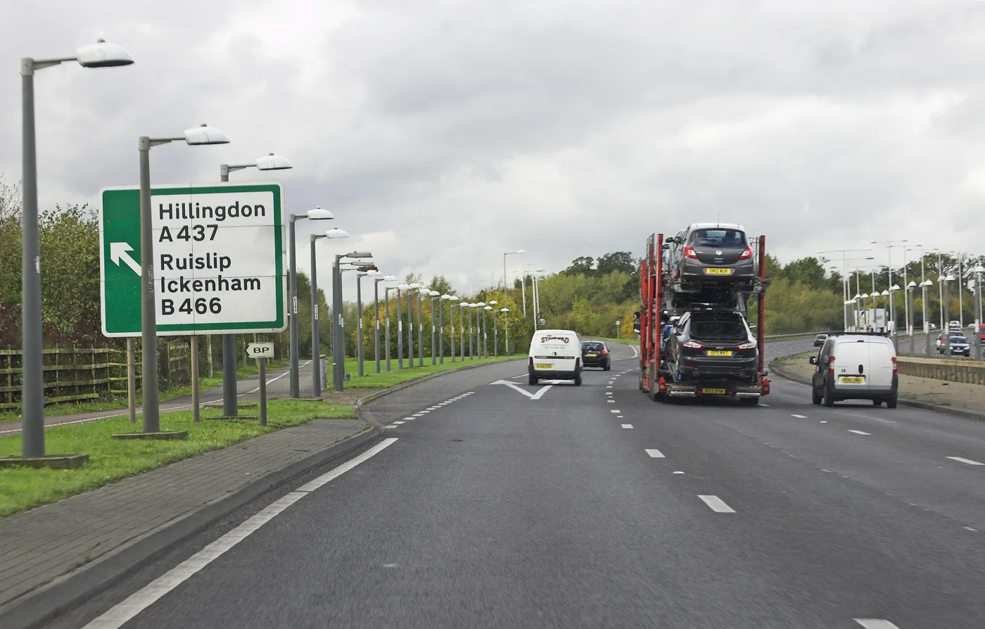

Hillingdon Council's draft air quality plan names 19 pollution hotspots, including Uxbridge, and sets out 54 actions. Comments close on Friday 20 November.
Hillingdon residents have until Friday 20 November to comment on the council’s plan to clean up the borough’s air over the next five years.
The draft Air Quality Action Plan for 2026 to 2030 names 19 “focus areas” where pollution is worst and most people are exposed. Uxbridge is one of them. The plan says every one of the 19 is forecast to stay above World Health Organization guideline levels throughout the plan period. (Hillingdon Council, draft Air Quality Action Plan 2026 to 2030)
Overview
- The consultation closes on Friday 20 November. You can share your views online.
- The draft has 54 numbered actions under five themes.
- Of the fine particle pollution (PM2.5) that starts inside Hillingdon, 41% comes from aviation and 20% from road transport.
- The council says air quality has improved since 2019, but nitrogen dioxide was still above the WHO guideline at every monitoring site.
Where the pollution hotspots are
The council’s focus areas are places that have broken the old EU limit for nitrogen dioxide and where many people live. Hillingdon added more where its monitors recorded high levels of fine particles. The plan says there is “a strong spatial correlation” between the focus areas and areas of high deprivation.
The 19 include:
- Uxbridge, and a separate area along the Uxbridge Road
- the A40 at Swakeleys Road, at Long Lane and at South Ruislip
- the area around Hillingdon Hospital
- Ruislip town centre, Eastcote village, and Northwood east and west
- Hayes, Harlington, Sipson, West Drayton and Yiewsley, and the Heathrow area
- the A4 and M4 corridors
The council plans to review the list in 2027/28, when it has more consistent data.
What causes it
The plan uses the London Atmospheric Emissions Inventory for 2022 to break down the pollution that starts inside the borough. A large share of fine particles blows in from outside London and beyond the UK, and is not counted here.
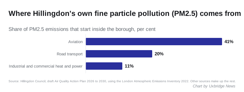
For coarser particles (PM10), aviation makes up 26%, road transport 25% and dust thrown back up from roads 14%. For nitrogen oxides, aviation and road transport are the two biggest sources. Among road vehicles, the biggest nitrogen oxide sources are diesel vans at 34.6%, diesel cars at 28.3% and petrol cars at 14.7%.
The council says most of these sources are outside its control. It restates its opposition to Heathrow expansion, partly because of air quality.
What the council plans to do
The 54 actions sit under five themes: monitoring, the urban environment, cleaner transport, protecting vulnerable people, and education. They include:
- a separate air quality action plan for Heathrow Airport, and new monitors for ultrafine particles in the Heathrow area
- an area action plan for each focus area, starting with those at highest risk
- monitors at schools in the most polluted areas, and more sensors that measure PM2.5
- requiring all new developments to be at least “air quality neutral”, and “air quality positive” inside focus areas
- making data centres use the lowest-polluting fuel for their backup generators
- promoting the smoke control zone and explaining the harm from wood burners
- making electric the preferred choice whenever a council vehicle is replaced
- working with schools on whether they could set up their own zero emission zones
The council runs 12 automatic monitoring stations and 44 nitrogen dioxide tubes across the borough. The council declared an Air Quality Management Area in 2003 for the whole borough south of the Chiltern-Marylebone railway line.
How the targets compare
| Pollutant | UK legal limit (annual mean) | WHO guideline (annual mean) |
|---|---|---|
| Nitrogen dioxide (NO2) | 40 µg/m³ | 10 µg/m³ |
| Fine particles (PM2.5) | 20 µg/m³ | 5 µg/m³ |
| Coarse particles (PM10) | 40 µg/m³ | 15 µg/m³ |
The plan says Hillingdon broadly meets the UK limits. Its 2030 forecasts show PM2.5 “entirely above” the WHO guideline and nitrogen dioxide remaining a concern around Heathrow.
What it means for you
- Have your say by Friday 20 November. The online form asks about the plan’s direction, its priorities and the measures under each theme.
- Need help with the form? Email residentempowerment@hillingdon.gov.uk. The council’s consultation page links a translation guide if you need an interpreter.
- Live in or near a focus area? The plan’s tables list each one with the reason it was chosen. Residents near the A40, the A4, the M4 and Heathrow are most affected.
- Use a wood burner? The plan commits the council to making sure smoke control zone rules are followed, and to explaining the harm wood burners cause.
Have your say